 Map Design: Amanda Click, Smith College ’17
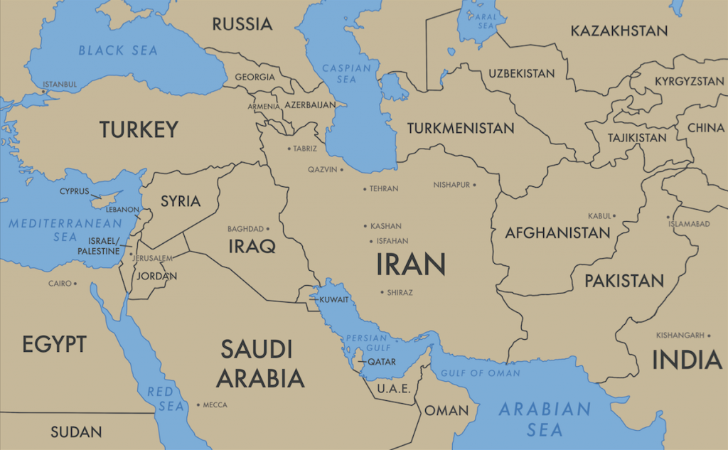
While this map doesn’t display the entire Islamic world, it was designed to display all of the locations and sites of production represented by this exhibition. The class decided collectively that a map would be the most effective way of situating the collection in its geographic context. Contemporary national borders, country names, and capital cities are present to assist in this contextualization.
[Detailed Image Description: a political map representing the Middle East and parts of Western Asia. The land masses are beige, and the bodies of water are filled in blue. Each country is labeled with its name, as well as a few cities. Its longitudinal range is from Turkey and Egypt in the West, to western China and India in the east. Its northernmost points are Kazakhstan and the Black Sea, and its southernmost points are northern Sudan and near the southern edge of the Arabian Peninsula (Saudi Arabia, Oman).]