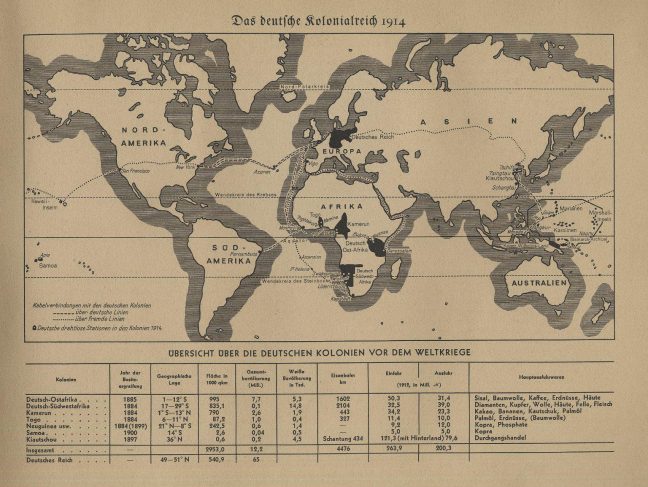
This map was published by the Cigarette Picture Service in Hamburg, Germany. The map details the ‘German Colonial Empire in 1914’, showing an overview of the German colonies (pre-WW1), as well as information into the different colonies’ year of establishment, location, area, population, railway, imports, and exports. This helps the viewer understand just how much Germany gained, stood to lose, and then lost during the war. It also emphasises the importance of trade on the economic stability needed to maintain overseas colonies, as well as international relations. This was published in 1935, potentially a tactic to enrage German citizens into remembering the ‘good old days’ when Germany had been a global superpower, as a way of drumming up support for World War Two and the new government that would be headed by Adolf Hitler.
Deutsche Kolonien (Germany Colonies)

